
Waterfalls
Yosemite is home to countless waterfalls. The best time to see waterfalls is during spring, when most of the snowmelt occurs. Peak runoff typically occurs in May or June, with some waterfalls (including Yosemite Falls) often only a trickle or completely dry by August. Storms in late fall rejuvenate some of the waterfalls and all of them accumulate frost along their edges many nights during the winter.

Alder Creek Fall
Height: 120 ft (37 m)
Flows: March to July with peak flows in late May
Near Wawona, Alder Creek flows through dense forest, a recent burn area and the remains of an old logging railroad. The trail is steep but not too rough or rocky and about 4 miles to reach Alder Creek Fall.

Bridalveil Fall
Height: 620 ft (189 m)
Flows: all year, with peak flow in May.
This is often the first waterfall visitors see when entering Yosemite Valley. In spring, it thunders; during the rest of the year, look for its characteristic light, swaying flow.
You can see Bridalveil Fall from near the tunnels on the Wawona Road (Highway 41) or Big Oak Flat Road (Highway 120) and from a signed parking lot on your way into Yosemite Valley. You can walk to the base via a short but steep (up to 24% slope) trail in just a few minutes.

Chilnualna Falls
Height: Approximately 2,200 ft (671 m)
Flows: all year, with peak flow in May
This waterfall, located in Wawona, hides behind twists and turns in the rock; it's impossible to see the entire fall at the same time.
You can't see this waterfall from a road; the only way to see the fall is to hike to its top via a steep trail

Horsetail Fall
Height: 1,000 ft (304 m)
Flows: approximately December through April
Horsetail Fall is famous for appearing to be on fire when it reflects the orange glow of sunset in mid- to late-February. It falls off of the east side of El Capitan and is best seen from just east of El Capitan.
To see Horsetail Fall, park at the El Capitan picnic area (on Northside Drive west of Yosemite Valley Lodge) or in turnouts just east of the picnic area. You can see the waterfall from the road.

Illilouette Fall
Height: 370 ft (113 m)
Flows: all year, with peak flow in late May.
While many hikers notice this waterfall as they're hiking toward Vernal Fall, the best place to see it is on the Panorama Trail, a few miles from Glacier Point. This waterfall is not visible from any road; it's only visible by hiking on steep trails.

LeConte Falls
Height: 229 ft (70 m)
Flows: All year with peak flows in late May
LeConte Falls is a waterfall on the Tuolumne River and the second largest falls on this river. Le Conte Falls is located just upstream of Waterwheel Falls is often confused for this waterfall as it too possesses several noteworthy waterwheels as it slides down the smooth granite in Tuolumne Canyon.

Lehamite Falls
Height: 1,180 ft (360 m)
Flows: Only in early Spring of after a heavy rainfall
Lehamite Falls is probably the most underappreciated significant waterfall in Yosemite National Park, simply because it's located almost right next to Yosemite Falls, so people don't usually pay any attention to it. It is one of the few features in the park that has retained its original Ahwaneechee name.

Nevada Fall
Height: 594 ft (181 m)
Flows: all year, with peak flow in late May.
You can see Nevada Fall (from a distance) at Glacier Point. The road to Glacier Point is open approximately late May through sometime in November. A wheelchair-accessible trail is available to the viewpoint when the road is open.
You can also hike beyond Vernal Fall to Nevada Fall on the Mist Trail.

Pywiack Cascade
Height: 600 ft (180 m)
Flows: March to September with peak flows in late May
The Pywiack Cascade is located a few miles downstream from the outlet of Tenaya Lake on Tenaya Creek at the head of the steep and rugged granite gorge, Tenaya Canyon. The waterfall can be viewed from Glacier Point, or by a 6-mile (9.7 km) hike from Olmsted Point, but the canyon is dangerous and the waterfall is unsafe to be reached on foot. The waterfall is highly seasonal and typically rages in the spring and early summer while shrinking to a trickle by late summer to mid-autumn.

Quaking Aspen Falls
Height: 25 ft (8 m)
Flows: March to late July
Quaking Aspen Falls is a 25-foot, multi-stranded waterfall off Tioga Road. Although the falls typically dry up by August, the stream flows year-round both above and below the falls.

Ribbon Fall
Height: 1,612 ft (491 m)
Flows: approximately March through June, with peak flow in May.
You can see Ribbon Fall from the road as you drive into Yosemite Valley, just beyond the turn for Bridalveil Fall

Sentinel Falls
Height: approximately 2000 ft (609 m)
Flows: approximately March through June, with peak flow in May.
This waterfall is located on the south side of Yosemite Valley, just west of Sentinel Rock. It is comprised of multiple cascades, which range in height from 50 - 500 feet.
You can see this waterfall from areas along Southside Drive near the Sentinel Beach Picnic Area, and near the Four Mile Trailhead. Alternatively, you can view it from across Yosemite Valley near Leidig Meadow, or while hiking the Upper Yosemite Fall Trail.

Silver Strand Falls
Height: 574 ft (175 m)
Flows: March through mid-June with peak flows in late May
Silver Strand Falls drops along Meadow Brook, at the western end of Yosemite Valley. Since Silver Strand Falls is located on streams draining small, relatively low areas, it dries up completely in a normal year by mid June since it is fed exclusively by melting snow.

Snow Creek Falls
Height: 2140 ft (652 m)
Flows: March through August, with peak flow in May
Snow Creek Falls is a long series of cascades located toward the eastern extent of Yosemite Valley. It descends a steep gorge on a sizeable stream that originates in May Lake to the north, dropping east of the trail that leaves the Valley above Mirror Lake en route to North Dome and other north-rim destinations.

Staircase Falls
Height: 1,300 ft (400 m)
Flows: March through late-June with peak flows in late May
Staircase Falls is a series of waterfalls located on Gossamer Creek. The falls descend into Yosemite Valley over a series of steps. Staircase Falls is relatively ephemeral and is usually dry by the end of June. The falls are located immediately behind Camp Curry on cliffs below Glacier Point.

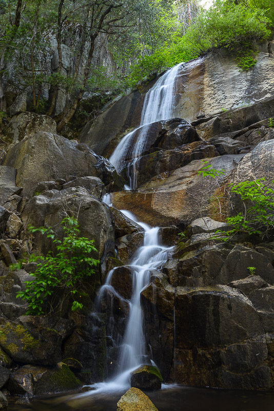
Three Chute Falls
Height: 80 ft (24 m)
Flows: March to September with peak flows in late May
Three Chute Falls is a waterfall on Tenaya Creek. The waterfall is located in lower Tenaya Canyon, a short distance upstream from Mirror Lake. The name is from the three distinct "chutes" that the creek splits into upon flowing onto a slab of granite atop the falls, after which it plunges into a congregation of boulders. The falls are easily reached by proceeding upstream along the Mirror Lake Trail. They are relatively obscure, and the trail requires some scrambling.

Tueeulala Falls
Height: 880 ft (270 m)
Flows: All year with peak flows in late May
Tueeulala Falls is located on the north side of Hetch Hetchy Valley. At roughly 880 feet it is the smaller of two large waterfalls that spill into Hetch Hetchy Reservoir, the other being Wapama Falls. It is, however, the larger of the two in terms of greatest free-fall distance, as Wapama is split into two falls. Tueeulala Fall drops free for 600 feet, hits a ledge, then slides steeply down 280 feet further. The hike to the top of the falls is off trail but fairly brush free and straightforward.

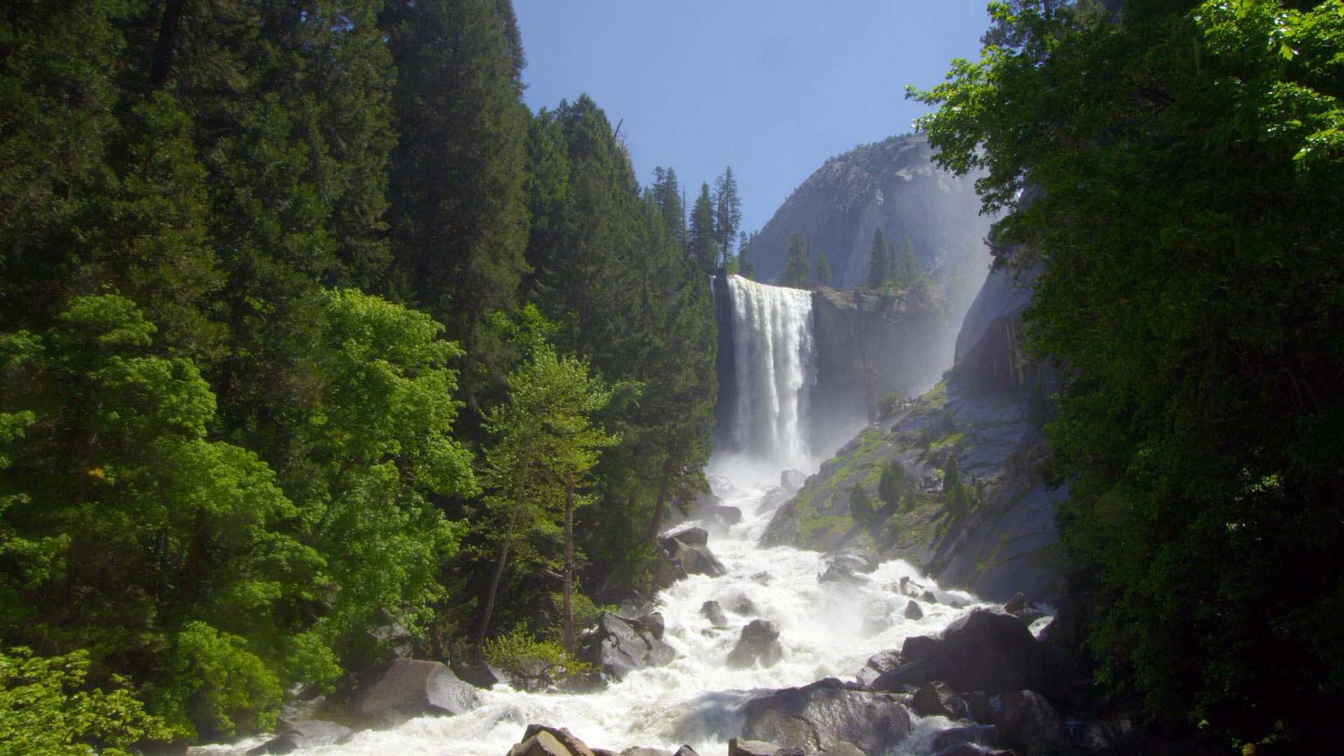
Vernal Fall
Height: 317 ft (97 m)
Flows: all year, though by mid to late summer, it narrows and separates into one, two, or three falls as water flows decrease; peaks in late May.
You can see Vernal Fall (from a distance) at Glacier Point. The road to Glacier Point is open approximately late May through sometime in November. A wheelchair-accessible trail is available to the viewpoint when the road is open.
You can also hike to Vernal Fall on the Mist Trail

Wapama Falls
Height: 1,400 ft (427 m)
Flows: all year, with peak flow in May.
Relatively few people visit Hetch Hetchy Valley to see this roaring waterfall. In some springs, the water from this fall flows over the footbridges near its base.
You can see this waterfall from the parking lot at O’Shaughnessy Dam or you can hike on an uneven trail to near its base

Waterwheel Falls
Height: 360 ft (110 m)
Flows: All year with peak flows in late May
It is the largest of the many waterfalls of the Tuolumne River. Its upper part contains a series of small ledges, each of which creates a small plume as the water is deflected away from the rock face. An extraordinary phenomenon appears at the first and largest of these ledges during the high-water season of early summer. Strong gusts of wind can lift part of the spray and blow it back upward, causing it to reenter the falls above the ledge. This cyclic "waterwheel" gives the falls their name.
Wildcat Falls
Height: 720 ft (219 m)
Flows: March to June, with peak flows in May
Wildcat Falls is located in the western quarter of Yosemite National Park alongside Highway 140, approximately 2.8 miles inside the park from the Arch Rock Entrance. It consists of a relatively thin string of falls and cascades totaling 720 feet. There are a total of seven drops in the waterfall, the longest being 120 feet. The base of the waterfall is a mossy grotto that is easily reached on foot.

Yosemite Falls
Height: 2,425 ft (739 m)
Flows: approximately November through July, with peak flow in May.
Look for the ice cone at the base of the upper fall during winter and for roaring runoff April through June. Yosemite Falls, one of the world's tallest, is actually made up of three separate falls: Upper Yosemite Fall (1,430 feet), the middle cascades (675 feet), and Lower Yosemite Fall (320 feet).
You can see Yosemite Falls from numerous places around Yosemite Valley, especially around Yosemite Village and Yosemite Valley Lodge. A one-mile loop trail leads to the base of Lower Yosemite Fall